Verona Map: Old Town, Station And Lake Garda
Verona, in Veneto, northern Italy, is an inland city wrapped in a loop of the Adige river, and reading its map correctly starts with that loop: the old town inside the bend, the station south of it, and Lake Garda's towns 22 to 39 km to the west as day trips.
Short answer
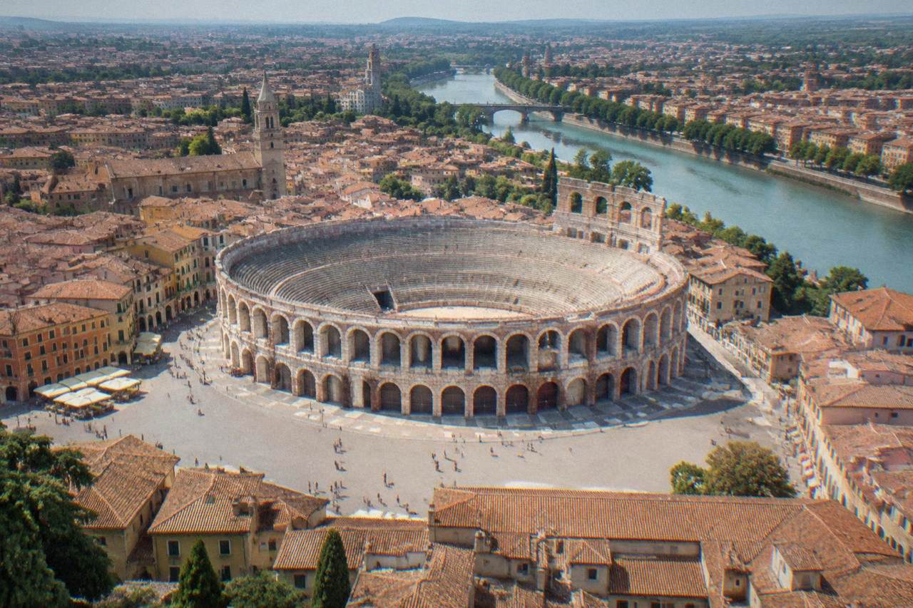
On any Verona city map the Roman Arena sits at the southern edge of the old town in Piazza Bra, the historic centre fills the inside of the Adige river bend, Porta Nuova station lies about 1.5 km south of the Arena, and Lake Garda's towns sit 22 to 39 km west of the city, reached by car, bus or train as day trips.
Verona, in Veneto, northern Italy, is an inland city on the Adige river, and its map is simpler than it first looks. The historic centre sits almost entirely inside a tight double bend of the river, with the Roman Arena at the southern edge, Piazza Bra opening in front of it and the shopping spine of Via Mazzini running north towards Piazza delle Erbe. South of the old town lies the station district around Porta Nuova, and west of the whole city, 22 to 39 km away, lies Lake Garda: Sirmione, Bardolino, Garda and Malcesine are lake towns, day trips from Verona, not districts of it. Verona itself has been a UNESCO World Heritage Site since 2000, inscribed for its urban fabric and fortifications. This page from the Verona Italy Travel Guide walks the city district by district, the way a good map does.
How Is Verona Laid Out On The Map?
Verona's map is organised around one dominant feature: the Adige river, which flows from the Alps north of the city, loops around the historic centre in a double S-bend and continues east towards the plain. The old town, Citta Antica, occupies nearly all the land inside the bend, with the Arena at its southern point and Veronetta on the left bank opposite. Borgo Trento lies north-west, San Zeno west of the old core, and Porta Nuova station south of the centre.
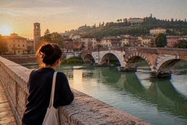
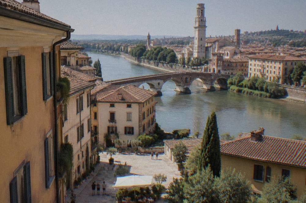
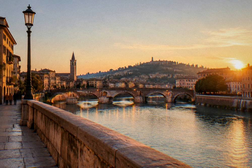
The river is the handrail for anyone reading the map for the first time. Ponte Pietra, the Roman pedestrian bridge, crosses the Adige at the north-east corner of the old town and leads up towards the Teatro Romano hillside and Castel San Pietro beyond it, a hilltop viewpoint across the river. Further south, Ponte Scaligero carries walkers from Castelvecchio across to the western bank. The upshot is that almost every Verona walk either crosses the Adige or follows it.
A second organising line is the north-south spine inside the bend: Piazza Bra and the Arena at the bottom, Via Mazzini running north, Piazza delle Erbe and Piazza dei Signori in the middle, and the Duomo complex towards the top near the river. The three-day Verona itinerary on this site follows that spine, and a shorter visit can walk the same line in a day.
The districts in map order, with their relation to the Arena:
| Area on the map | Position relative to the Arena | Character by position |
|---|---|---|
| Citta Antica (old town) | The Arena sits at its southern edge | The whole historic core inside the Adige bend |
| Veronetta | Across the Adige, east of the old town | Left-bank quarter reached by Ponte Pietra or Ponte Navi |
| Borgo Trento | North-west, across the river | Residential quarter upstream on the Adige |
| San Zeno district | West of the old core, outside the bend | Quarter around the Basilica di San Zeno |
| Porta Nuova station area | South, outside the old walls | City expansion around the station |
No neighbourhood carries a sourced safety score, price level or characterisation beyond its place on the map, so position and walking relation are what this page reports. The where to stay in Verona guide covers the practical side of choosing between them.
What Sits Inside The Verona Old Town On The Map?
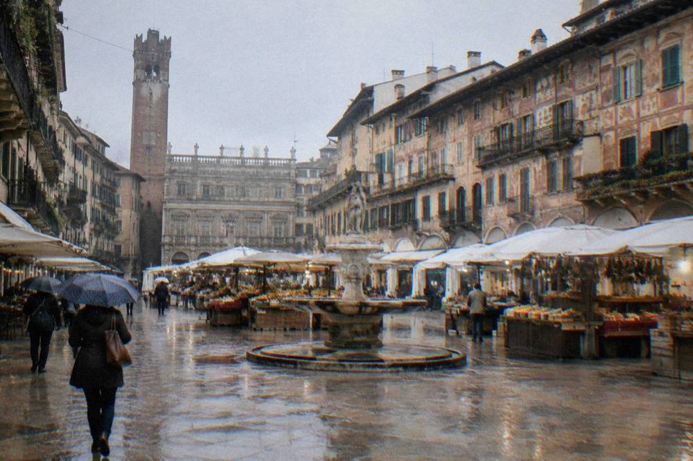
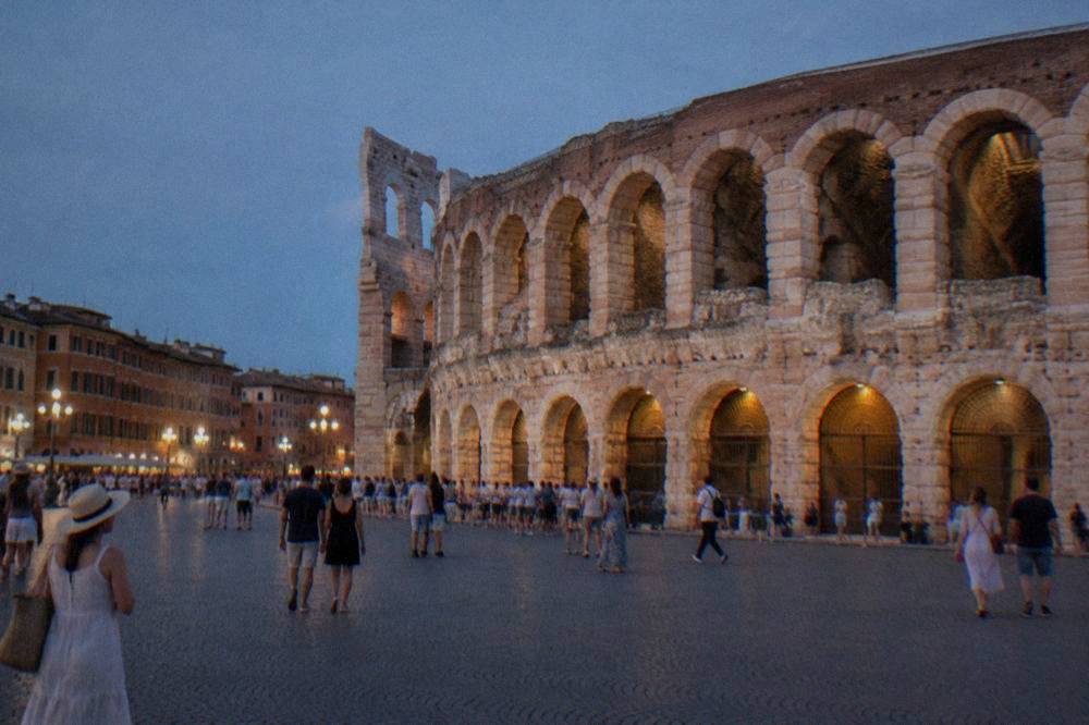
The Verona old town on a map holds, from south to north: the Arena in Piazza Bra, the Casa di Giulietta a few blocks north-east, Piazza delle Erbe and Piazza dei Signori at the centre, the Torre dei Lamberti between them, the Duomo complex to the north, and Ponte Pietra at the north-east corner where the old town meets the river and Veronetta. Everything on that list is within walking distance of everything else, which is why the old town reads as one compact district rather than several.
Two of these carry 2026 prices worth knowing before you trace a route. The Arena can be visited by day for 12 euro full fare, 9 euro reduced, per the Comune di Verona's own price list, and it closes on Mondays with early closes on opera evenings, hours reported by the civic museums and worth confirming before you go. The Casa di Giulietta changed in April 2026: the courtyard route costs 5 euro and the full house-and-balcony route 12 euro, with online booking and entry via the Teatro Nuovo, per the Comune's own notice. The balcony itself is not original: it was added in 1940, per the city's tourism office.
| Landmark | Place on the old-town map | Admission (2026) |
|---|---|---|
| Arena di Verona | Southern edge, Piazza Bra | 12 euro full, 9 reduced, 3 for ages 18-25 |
| Casa di Giulietta | North-east of Piazza Bra, off Via Mazzini | 5 euro courtyard, 12 euro house route, booked online |
| Torre dei Lamberti | Between Piazza delle Erbe and Piazza dei Signori | 6 euro full, reported; free with VeronaCard |
| Piazza delle Erbe | Centre of the old town | Open access, free |
| Ponte Pietra | North-east corner, over the Adige | Open access, free |
| Porta Borsari | South-west edge of the old core | Open access, free |
The stone core of the old town rewards a guided read. The Verona walking tour pages on this site cover the guided options, and for visitors who want the map explained with a bit of pace, the bike tours below are a good fit.
The old town's medieval fabric is what UNESCO listed in 2000, and its map is dense: the Scaliger tombs by Santa Maria Antica, the Courtyard of the ancient market at Piazza dei Signori, and the churches strung along the river-side streets. Admission prices and hours vary, so confirm those locally; the VeronaCard is reported to cover several of the churches under the Chiese Vive convention.
How Far Is Verona Porta Nuova Station From The Old Town On The Map?
Verona Porta Nuova station sits south of the old town, roughly 1.5 km from the Arena, on the far side of the broad ring of streets that replaced the old walls, and the walk from the station forecourt to Piazza Bra crosses that ring in a straight line up Via Roma and through Porta Nuova itself, the gate that gives the station its name. The station district is flat, and the whole route is inside the built-up city, not a suburban transfer.
Trains arrive here from across northern Italy and beyond. Reported journey times from Porta Nuova: Venice Mestre 58 to 75 minutes, Milano Centrale 1 hour 15 to 1 hour 50, and Rome about 3 to 3 hours 30. Venice direct is reported at 1 hour to 1 hour 15. No ticket fare is printed on this page; check the operators' own sites for prices. The Verona train station guide covers the arrival side in detail.
From the airport side, Verona Villafranca (VRN) lies 26 minutes by road from the Arena, computed over standard routing, and the Aerobus line 199 connects the airport to the station area in a reported 15 minutes for a reported 7 euro one way, per ATV, the local operator; confirm the fare before you travel. Inside the city, an urban bus single costs 1.50 euro and is valid 90 minutes, per ATV's own fare page.
| Route on the map | Figure | Basis |
|---|---|---|
| Porta Nuova station to Piazza Bra (walk) | about 1.5 km, direct line | Map position |
| VRN airport to Arena by road | about 26 minutes | Computed over OSM routing |
| Aerobus 199 airport to station | about 15 minutes, 7 euro reported | Per ATV, confirm before you go |
| Urban bus single | 1.50 euro, 90 minutes | ATV fare page |
| Train to Venice Mestre | 58 to 75 minutes reported | Per operator listings, times only |
| Train to Milano Centrale | 1 h 15 to 1 h 50 reported | Per operator listings, times only |
For travellers splitting a stay, the question of basing in the city or on the lake comes down to this map: the Verona or Lake Garda comparison weighs it, and luggage between stations is covered in the luggage storage guide, which advises confirming current options locally at Porta Nuova.
Where Is Lake Garda On The Map Compared To Verona?
Lake Garda lies west of Verona, and the lake towns sit 22 to 39 km from the city: Sirmione about 43 km by road and 40 minutes' drive from the Arena, Bardolino about 30 km and 37 minutes, the town of Garda about 40 km and 42 minutes, and Malcesine about 66 km and 84 minutes at the northern end. Verona is an inland city on the Adige, not a lakeside town, so every lake visit is a day trip with a road, rail or bus leg in it.
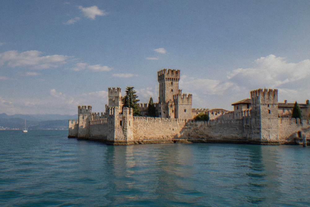
The drive times above are computed over OSM routing in free-flow conditions, so real traffic on summer weekends will stretch them. Sirmione, the closest headline destination, is in Brescia province, Lombardy, not Verona province, despite being the lake town advertised from Verona. The ATV line 164 bus is reported to run from Porta Nuova towards Sirmione in about 55 minutes direct and to also serve Peschiera, Lazise, Bardolino and Garda; check ATV for the fare before riding. Regional trains also reach Peschiera and Desenzano on the lake's south shore.
On the lake itself, the Navigazione Laghi ferry network connects the towns, and a full-lake day pass cost 39.50 euro for an adult under the 2026 fares on the operator's own rates page. Note the seasonal shape, reported from the operator's timetable: full summer service ran 16 May to 4 October 2026, autumn service reduced to 1 November, and the north-south passenger service is suspended from 2 November 2026 to 12 March 2027.
| Lake Garda town | Distance and drive time from the Arena | Notes |
|---|---|---|
| Sirmione | about 43 km, 40 minutes | Brescia province; Grotte di Catullo 10 euro reported |
| Bardolino | about 30 km, 37 minutes | East shore, served by bus 164 |
| Garda (the town) | about 40 km, 42 minutes | Not Riva del Garda, which is 51 km away in Trentino |
| Malcesine | about 66 km, 84 minutes | Monte Baldo cable car base |
The lake's shape matters on the map: it is long and narrow, and the northern end around Malcesine is a mountain landscape, while the southern shore around Sirmione and Peschiera is the flat, ferry-connected part closest to Verona. The Lake Garda day-trip guide and the Verona and Lake Garda itinerary build routes around that geography.
Which Verona Areas Should A Visitor Know By Name?
Five names cover the whole Verona map: Citta Antica (the old town inside the river bend), Veronetta on the left bank across the Adige, Borgo Trento to the north-west, the San Zeno district to the west, and the Porta Nuova station area to the south. Each is defined by its position relative to the river and the Arena, and all are walkable from the centre except the outer edges of the station district and San Zeno.
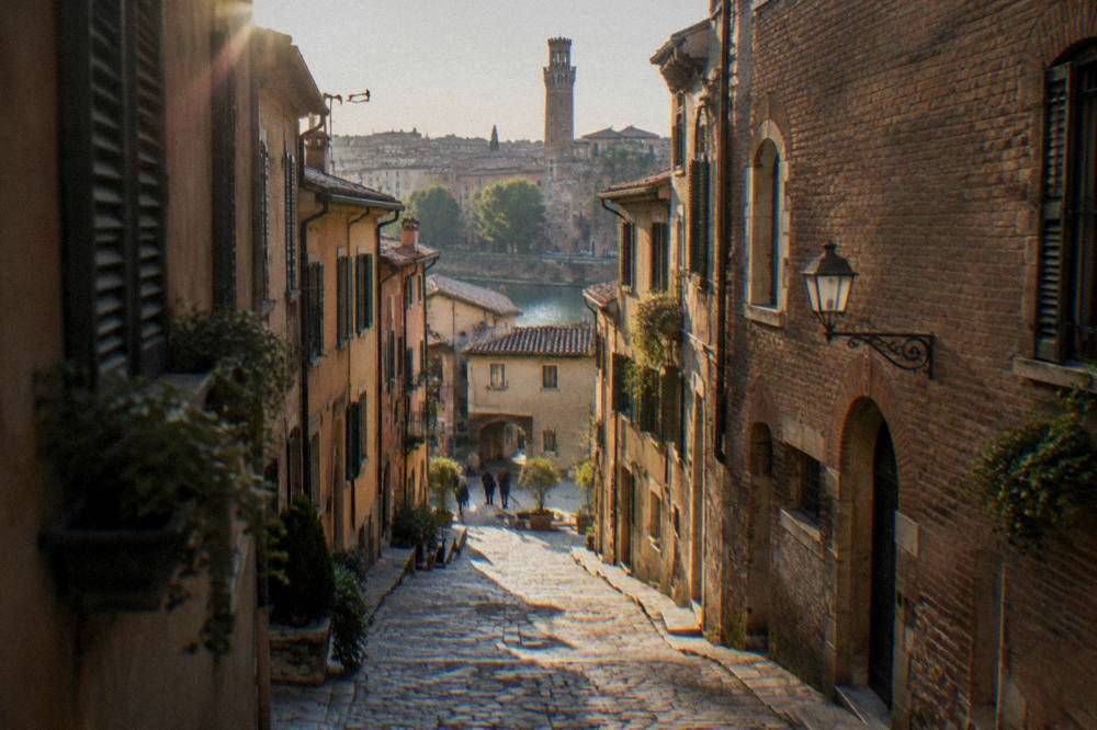
The Citta Antica area guide and the station district guide expand on the two visitors use most. Veronetta, reached over Ponte Pietra or Ponte Navi, holds the Teatro Romano hillside and a quieter street fabric; Borgo Trento spreads north-west along the river's right bank; San Zeno grew around the Basilica di San Zeno at the western edge of the map. The Basilica's admission is handled under the Chiese Vive convention with the VeronaCard, per the Comune's card notice, but its standalone price and hours should be confirmed locally.
An aside worth flagging for itinerary planning:
How Does The ZTL Read On A Verona Map?
On the Verona map, the ZTL, the limited-traffic zone, covers the historic centre inside the Adige bend, camera-policed at its gates, and non-residents may drive in at most four times a month, booked in advance, within set windows: Monday to Friday 10:00 to 18:00 and 20:00 to 23:00, and Saturdays, Sundays and holidays from 10:00 to 13:30, per the Comune di Verona's own ZTL notice. Hotel guests are exempt from the entry limit if their hotel registers the plate.
The practical map consequence is simple: a visitor with a rental car parks outside the ZTL and walks in, or books a hotel inside it and lets the hotel handle the plate. Short-term rental apartments do not get the hotel exemption. Fines are camera-enforced. The ZTL and parking guide on this site is the wrong page for that; the driving guide covers it, and the two-day itinerary shows how little a car is needed inside the bend.
Everything inside the ZTL is on foot. Via Mazzini, the pedestrian shopping street, runs the length of the old core from Piazza Bra to Piazza delle Erbe, and the whole inner map, Arena to Duomo to Ponte Pietra, is a walk of a kilometre or so in each direction.
Which Day Trips Sit Within An Hour Of Verona On The Map?
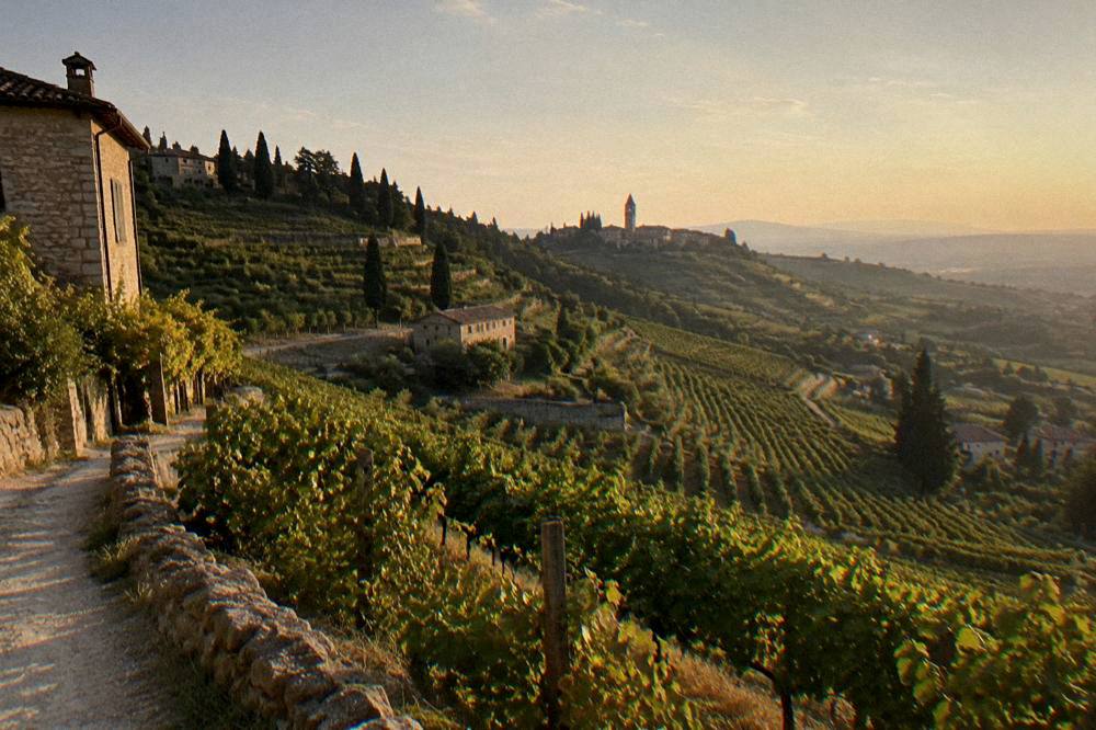
Within about an hour's drive of the Arena, computed over OSM routing in free-flow conditions, the map holds: Valpolicella's wine hills at about 25 minutes, Soave at 33, Bardolino at 37, Sirmione at 40, the town of Garda at 42, Vicenza at 48, Mantua at 54, Padua at 67, Malcesine at 84 and Venice at about 85 minutes. Train times are shorter than driving to some of these: Venice Mestre is 58 to 75 minutes by rail, reported.
| Day trip | Drive from the Arena | What the map shows |
|---|---|---|
| Valpolicella (Sant'Ambrogio) | about 25 minutes | Wine hills north-west of the city |
| Soave | about 33 minutes | Walled town and castle east of Verona |
| Bardolino | about 37 minutes | East shore of Lake Garda |
| Sirmione | about 40 minutes | Peninsula at the lake's south end |
| Vicenza | about 48 minutes | Palladian city on the plain |
| Mantua | about 54 minutes | Renaissance city between three lakes |
| Padua | about 67 minutes | City of the Santo, south-east |
| Venice | about 85 minutes | Lagoon city, reached by train in 58-75 min reported |
The lake towns to the west dominate the day-trip map, and two questions come up constantly: how far Verona is from Lake Garda and which lake town is considered the prettiest. For those who prefer not to drive, a guided lake day solves the geography in one booking.
When Does The Verona Map Change With The Seasons?
The Verona map itself does not move, but three things on it are seasonal: the Arena's opera season, which ran 5 June to 12 September in 2026 and is announced for 11 June to 11 September 2027, the Monte Baldo cable car at Malcesine, whose 2026 season ran about 4 April to 1 November, reported, and the Lake Garda north-south ferry service, suspended from 2 November 2026 to 12 March 2027, reported. A winter map of the region has fewer lake connections and no opera, but the city core runs all year.
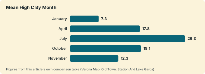
Climate shapes the walking map, too. The ERA5 reanalysis, 1991-2020, for Verona gives a January mean high of 7.3 C and a low of minus 0.4 C, a July mean high of 29.3 C with overnight lows of 19.1 C, and November as the month with the highest rainfall total, 118.2 mm, against January's 52.3 mm. Those are modelled normals, not a station record, but they explain why the spring and autumn shoulders suit the long walking days the old-town map demands.
| Month | Mean high C | Mean low C | Rain mm |
|---|---|---|---|
| January | 7.3 | -0.4 | 52.3 |
| April | 17.8 | 7.6 | 93.5 |
| July | 29.3 | 19.1 | 79.4 |
| October | 18.1 | 10.5 | 107.2 |
| November | 12.3 | 5.3 | 118.2 |
The best time to visit Verona and Verona weather guides carry the full table month by month. On an opera evening the map tightens around Piazza Bra: gates are reported to open about two hours before a 21:00 or 21:30 start, and the stone-step seats start in the 30-euro range, per the Arena's rates page, with exact sectors to be confirmed there before booking.
Common Questions About The Verona Map
Is Verona On Lake Garda?
No. Verona is an inland city on the Adige river in Veneto. The Lake Garda towns, Sirmione, Bardolino, Garda and Malcesine, lie 22 to 39 km west and are day trips, not districts of the city.
How Far Is Verona Train Station From The Arena?
Porta Nuova station sits about 1.5 km south of the Arena, on the far side of the broad street ring where the old walls once stood. The walk is direct and flat, up through Porta Nuova itself to Piazza Bra.
Can You Walk Everywhere In Central Verona?
Yes, inside the Adige bend. The old town from the Arena to Ponte Pietra is roughly a kilometre each way, Veronetta lies just across the river, and the station district is a short walk south. A car is a liability inside the ZTL, not a help.
Which Side Of Verona Is Lake Garda On?
West. Sirmione is about 40 minutes' drive from the Arena, Bardolino 37, the town of Garda 42 and Malcesine 84, computed over standard routing. Trains also reach Peschiera and Desenzano on the south shore.
Is The Verona Historic Centre A Restricted Zone For Cars?
Yes. The ZTL covers the centre inside the river bend, camera-enforced, with at most four entries a month for non-residents on advance booking within set windows, per the Comune di Verona. Hotel guests are covered if the hotel registers their plate.
The Verona map, read once properly, keeps paying off: the river bend as the boundary of the old town, the station south of it, the lake west of it, and every headline sight inside a short walk of Piazza Bra.